Compiled by Ciarán Cooney, Hon Photographic Archivist
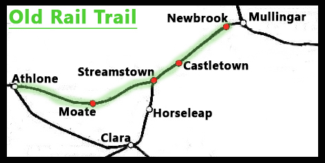
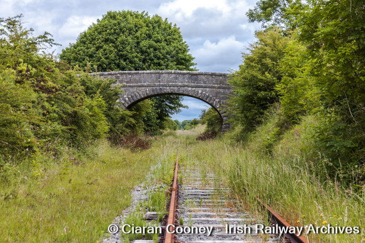
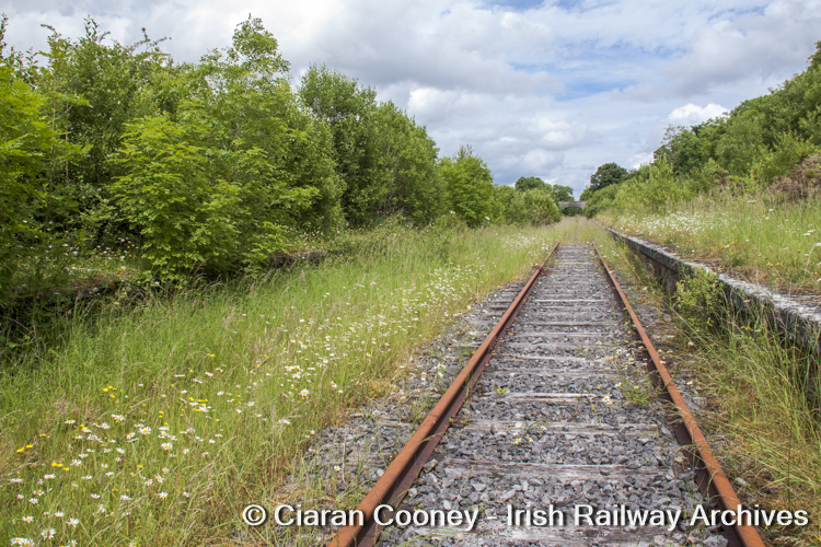
The 40km stretch of disused railway line between the towns of Mullingar and Athlone , formerly the Midland Great Western Railway’s Dublin-Galway mainline, was redeveloped into the Old Rail Trail Newbrook, Castletown, Streamstown and Moate , nine years after I had photographed them in their then overgrown condition in 2012. The railway was originally opened by the MGWR in 1851 as a double-track mainline. It was converted to single-line in May 1929 by the Great Southern Railways, with intermediate passing loops retained at Castletown, Streamstown, Moate and the 73rd-Milebox.
Most of the Galway and western line services ceased operating over the route after April 1973, leaving a skeleton service mainly consisting of night mail trains. The last scheduled passenger and freight trains ran over the route in 1987. However, it remained in use for excursion trains and diverted services until 1995. Engineering trains also operated over the line on an infrequent basis until approximately 2003, with the last rail-movement occurring in 2006.
1) Newbrook (Mullingar Racecourse)
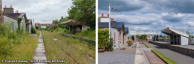
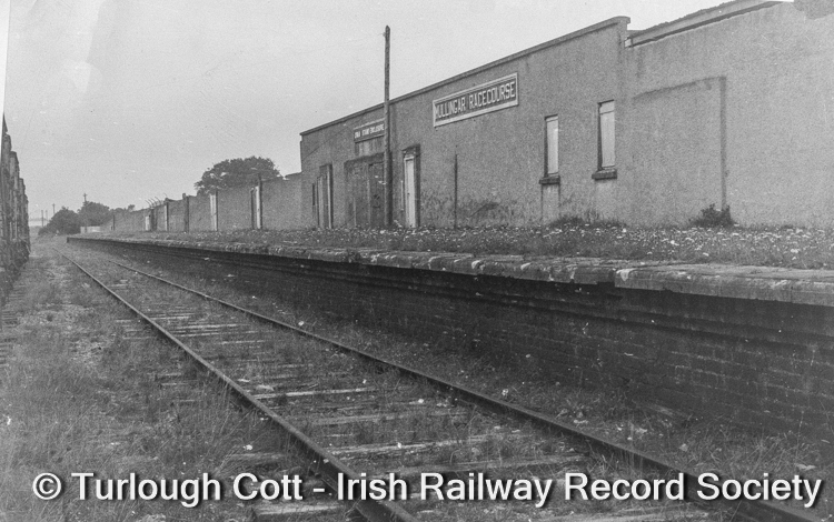
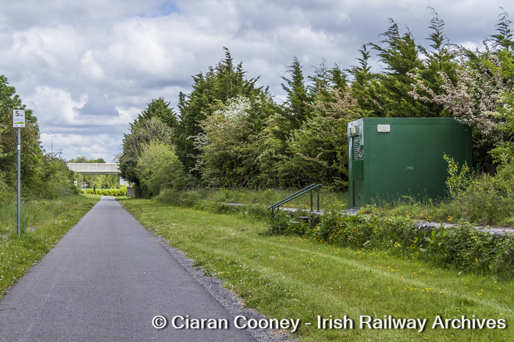
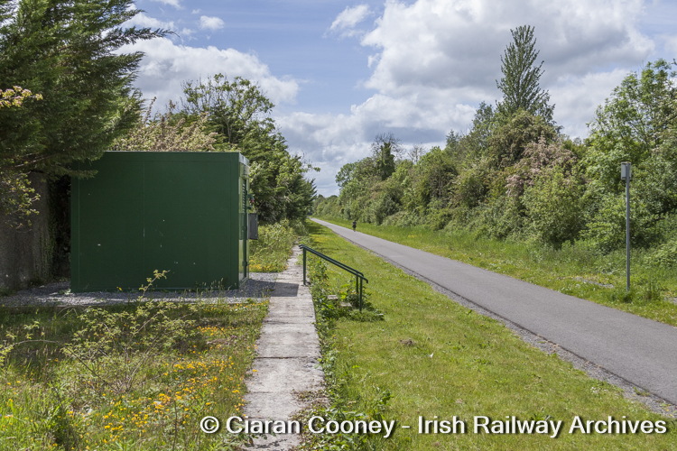
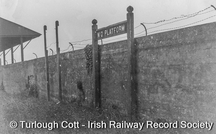
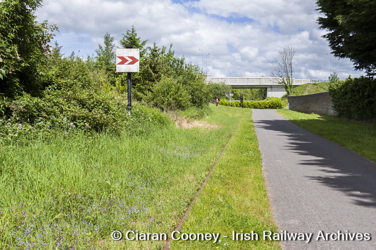
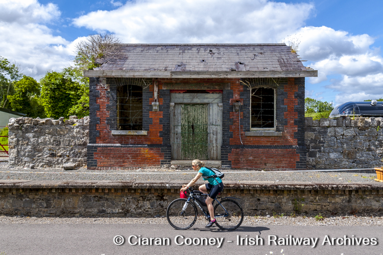
Newbrook looking west towards Athlone in July 1950. This station served Mullingar Racecourse and had two platforms located on the Down side of the line and accessed via a loop and siding. In this view is Platform No. 2 and the course grandstands. [Photo © R N Clements – Irish Railway Record Society] Newbrook pictured in June 2021, where the Old Rail Trail begins. The boundary wall of the racecoure and No.1 Platform still exist, but the racecourse is now an industrial estate . [Photo © Ciaran Cooney] Newbrook No. 1 Platform, looking east towards Mullingar in September 1963, showing the main entrance to the racecourse. The loop and siding were used in later years to store redundant rolling stock. [Photo © Turlough Cott – Irish Railway Record Society] Newbrook No. 1 Platform, looking east towards Mullingar in June 2021. The greenway of the Old Rail Trail ends at the new bridge in the distance. [Photo © Ciaran Cooney] View along Newbrook No. 1 Platform, looking towards Athlone. The boundary wall of the old racecourse is visible on the left. [Photo © Ciaran Cooney] No. 2 Platform sign at Newbrook, pictured in September 1963, with one of the racecourse grandstands visible in the background. [Photo © Turlough Cott – Irish Railway Record Society] The Up fixed distant signal board for Mullingar, pictured in 2021 at the east end of Newbrook. The disused single-line is visible in the foreground. [Photo © Ciaran Cooney] 2) Castletown
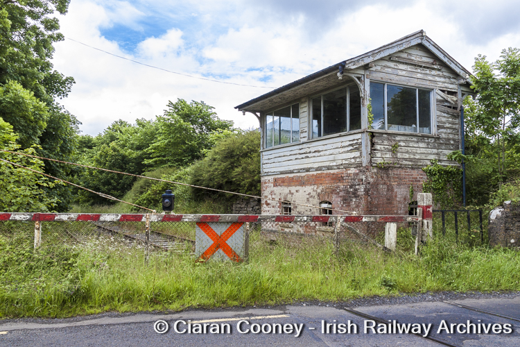
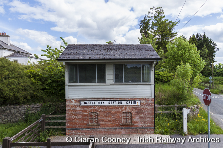
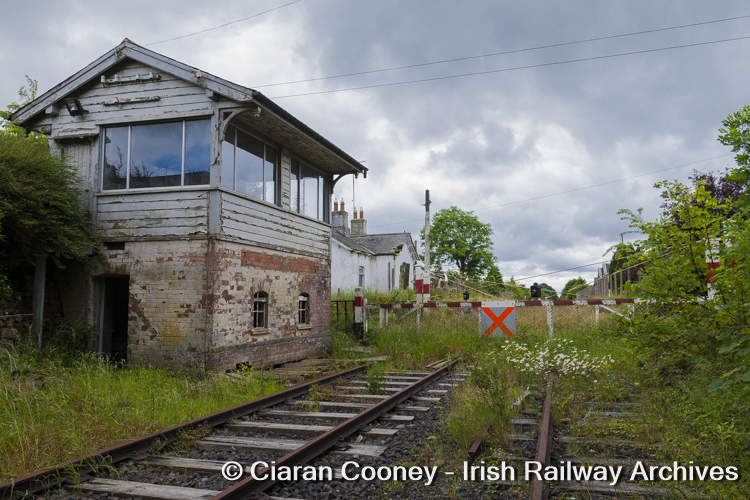
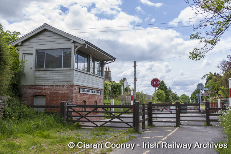
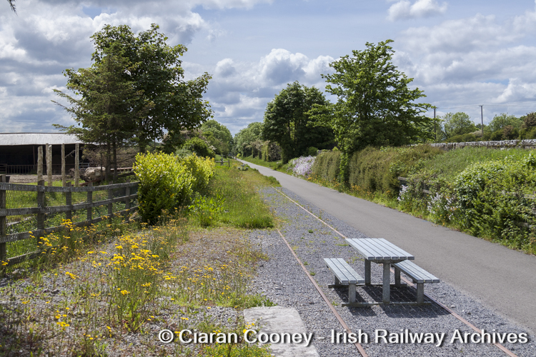
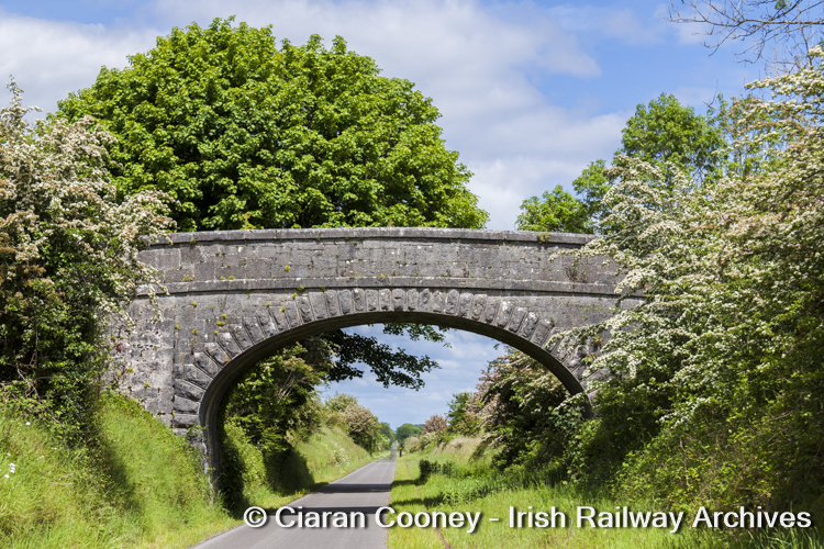
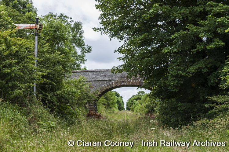
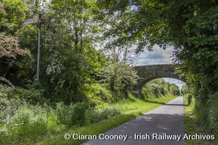
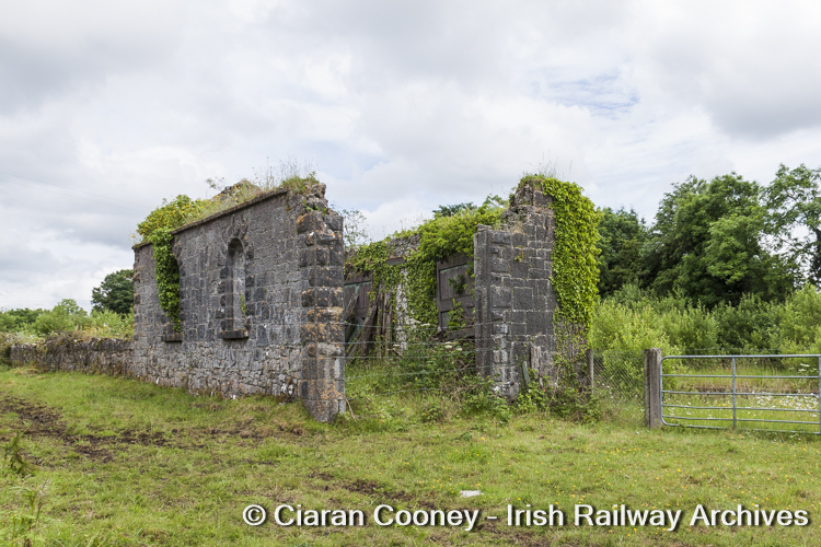
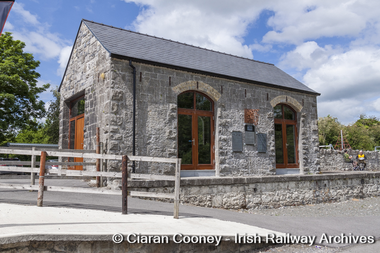
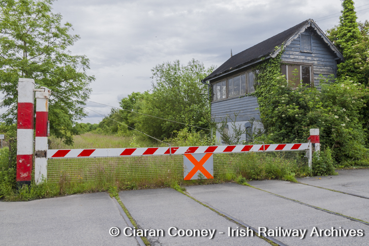
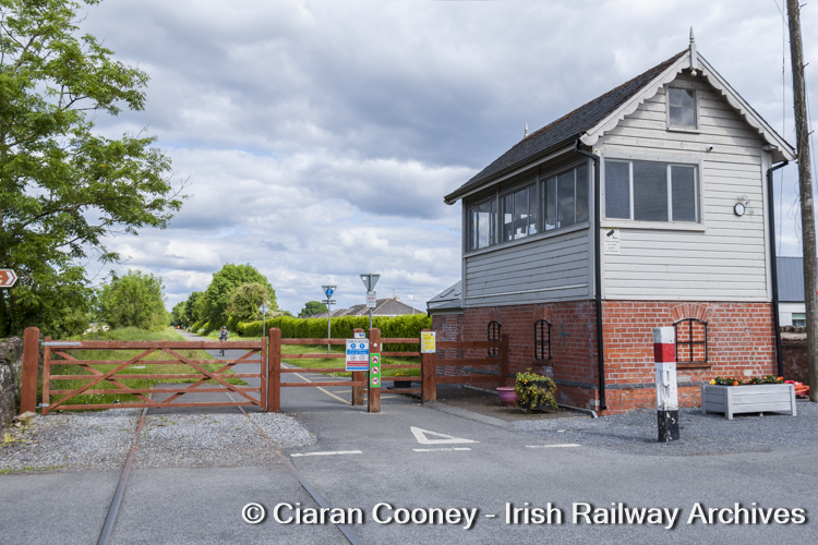
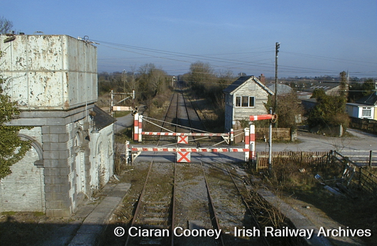
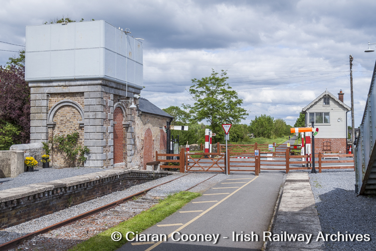
Castletown Station, looking east towards Mullingar in June 2012. Closed in 1963, the station remained a busy blockpost until September 1985. Although disconnected, the loop line remained in-situ. [Photo © Ciaran Cooney] Castletown Station in June 2021. The old passing loop has now been removed to makeway for the Old Rail Trail greenway. The station buildings have also been renovated. [Photo © Ciaran Cooney] Recorded in 2012, the Midland Great Western Railway style signal cabin at Castletown, located at the Mullingar end of the station adjacent to the level crossing. The cabin was closed in September 1985. [Photo © Ciaran Cooney] The now restored Castletown signal cabin in June 2021, complete with original nameboard. [Photo © Ciaran Cooney] Side-profile view of the Midland Great Western Railway signal cabin at Castletown, showing the reinstated nameboard in 2021. [Photo © Ciaran Cooney] View looking west towards Athlone, showing the signal cabin, level crossing and station at Castletown when in a forlorn condition during June 2012. In the foreground is the old passing loop. [Photo © Ciaran Cooney] Similar compositon to the previous picture; the old level crossing gates have been removed and the former loop line lifted. [Photo © Ciaran Cooney] This corrugated-iron goods store with platform survived at the western end of Castletown Station in 2012; it has since been removed. [Photo © Ciaran Cooney] View from the Down platform at Castletown Station, looking west towards Athlone in June 2021, showing the grass-covered track. The overgrown loop line and stone built goods shed is visible on the right. [Photo © Ciaran Cooney] View from Castletown’s Down platform during June 2021; the passing loop has been removed but the main running line has been retained, albeit with picnic bench and seating installed. [Photo © Ciaran Cooney] Accommodation bridge located on the Mullingar side of Castletown, which featured briefly in ‘The First Great Train Robbery’ film. This view of the overgrown line was recorded in 2012. [Photo © Ciaran Cooney] The same accommodation bridge but pictured June 2021, now tidied up and the greenway installed along the trackbed of the former Up line to Mullingar. The Up line had been removed in 1929. [Photo © Ciaran Cooney] On the Mullingar side of the accommodation bridge at Castletown is the Down distant semaphore signal for the level crossing at the station, a typical CIE type pictured in June 2012. [Photo © Ciaran Cooney] The Down semaphore signal for the level crossing at Castletown Station, retained post-greenway. Following closure of Castletown as a blockpost in September 1985, only the distant signals for the level crossing were retained. [Photo © Ciaran Cooney] View looking towards Athlone from Killians level crossing in June 2012, located on the western side of Castletown. The signal is positioned on the trackbed of the former Up line. This signal has also been retained along the Old Rail Trail but repositioned to face Mullingar. [Photo © Ciaran Cooney] 3) Streamstown Junction
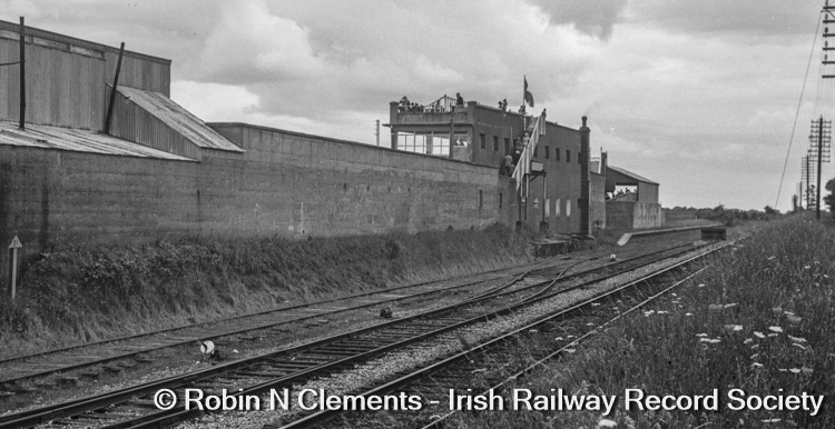
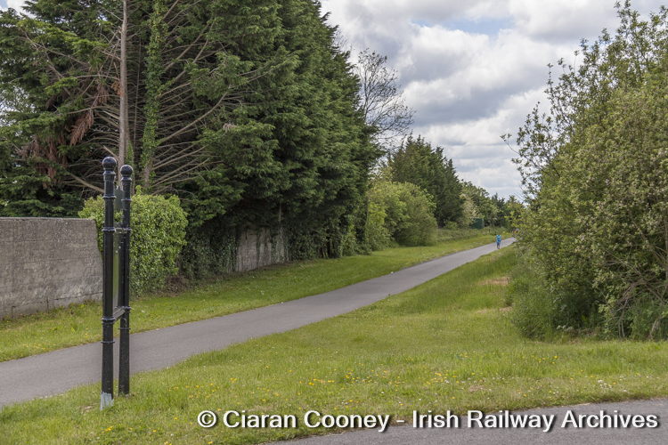
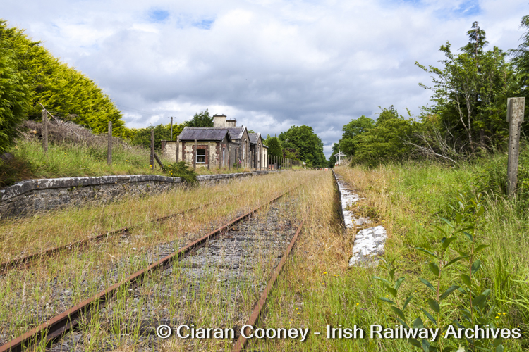
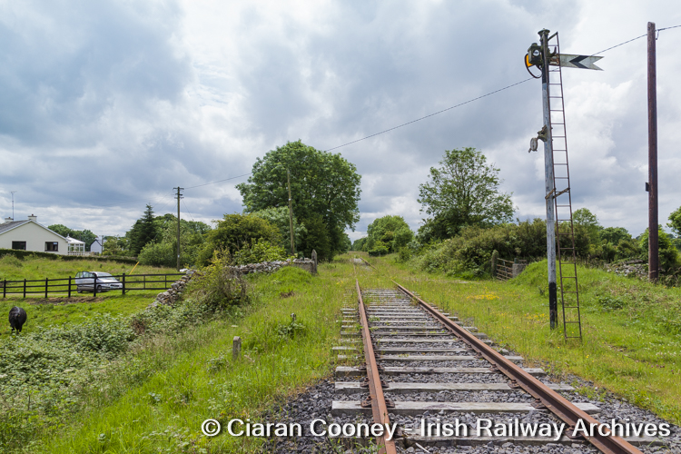
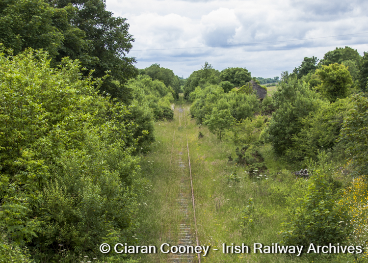
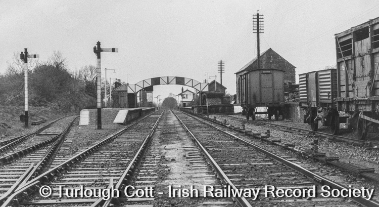
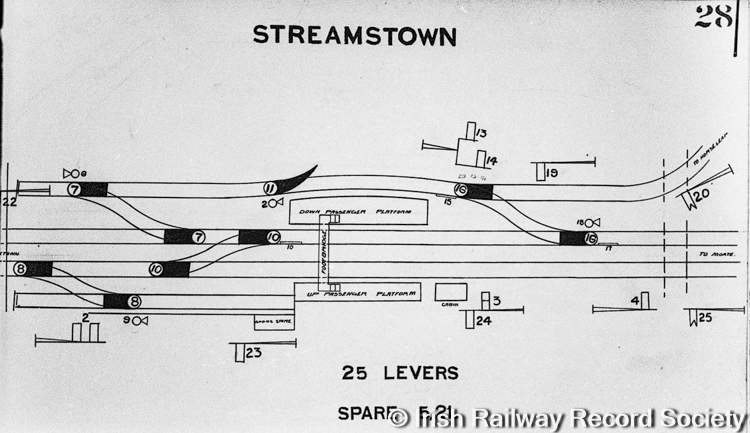
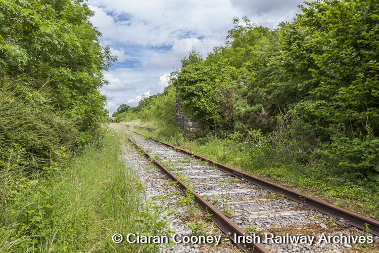
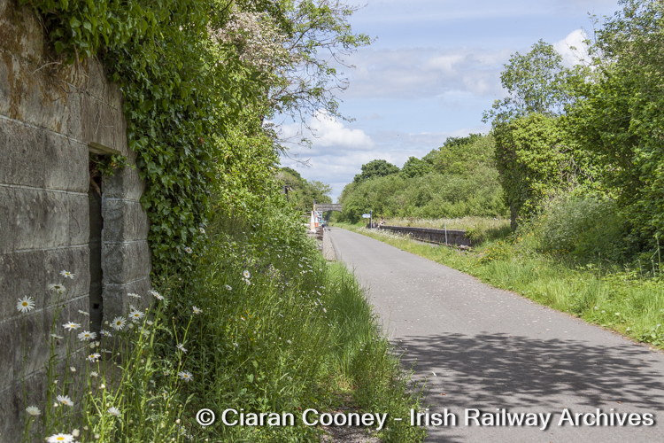
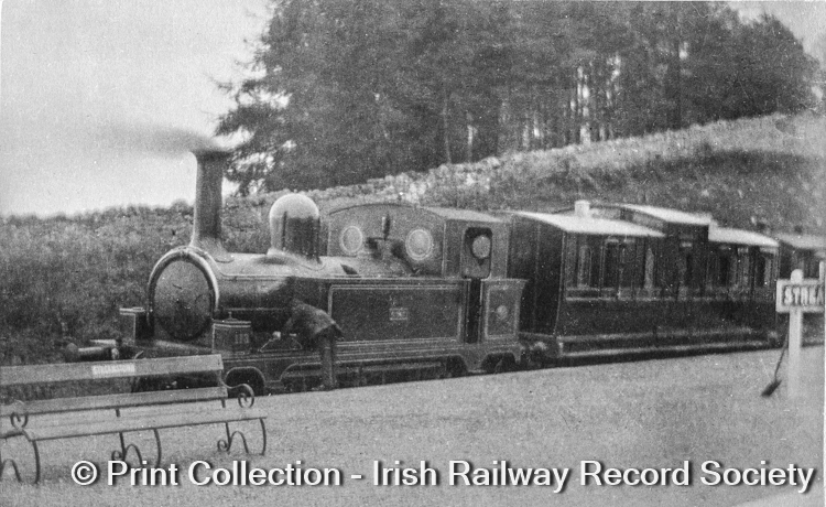
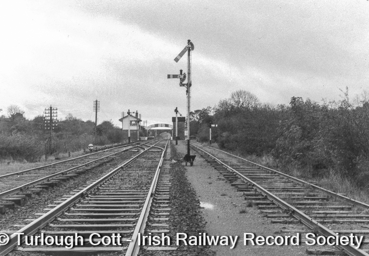
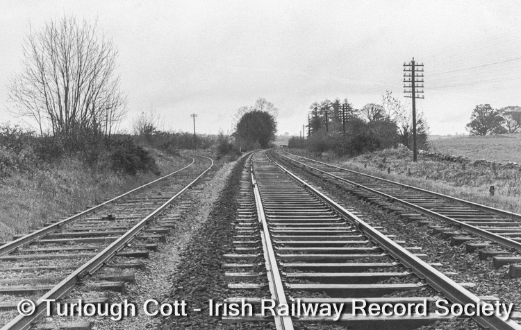
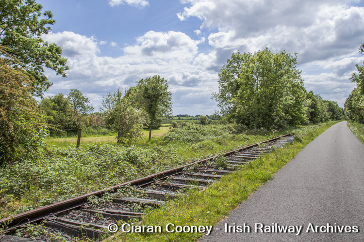
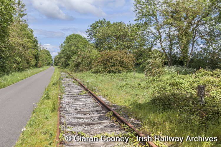
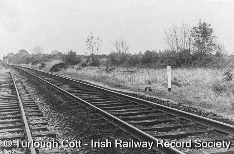
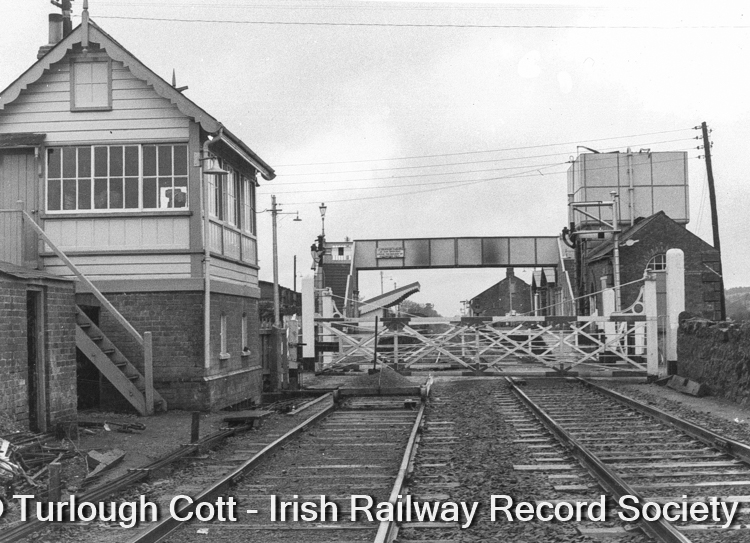
During June 2012, the former junction station at Streamstown was barely visible through the undergrowth. This view from the road bridge is looking towards Athlone. Formerly the junction for the branch to Clara via Horseleap, the station closed completely in 1963. [Photo © Ciaran Cooney] June 2021 sees Streamstown Station revealed, showing the former Up & Down platforms (the latter an island platform that served the Clara branch), waiting shelter, cattle bank and small goods shed. The site is now rest-stop for walkers and cyclists on the Greenway. [Photo © Ciaran Cooney] Streamstown Station, November 1962, showing the station buildings and platforms, with the Horseleap branch diverging to the left. [Photo © Turlough Cott – Irish Railway Record Society] Streamstown track-diagram during the Midland Great Western Railway era, circa 1925. In June 1957, the junction layout was remodelled by CIE, with the connection to the Clara-Horseleap branch at the Athlone end of the station removed, leaving just a direct connection at the Mullingar end. [Diagram © Irish Railway Record Society] Streamstown Station, looking east towards Mullingar in June 2021. During this time, both the goods shed and waiting shelter were obscured by trees and shrubs. To the left is the trackbed of the loop which was on the Up side of the station. The Down platform on the right was 378ft in length. [Photo © Ciaran Cooney] Extensive clearance of trees and shrubs have now revealed the former Up platform (299ft in length), waiting shelter and goods shed. The station now serves as a rest point for cyclists and walkers. [Photo © Ciaran Cooney] The goods shed at Streamstown, pictured forlorn and abandoned in June 2012. [Photo © Ciaran Cooney] Streamstown goods shed, now restored June 2021. [Photo © Ciaran Cooney] Streamstown good shed, as viewed from the railway side. The goods bank has also been been tidied up. The station was closed to passengers and goods services in June 1963. [Photo © Ciaran Cooney] The Midland Great Western Railway brick built waiting shelter located on the Up platform at Streamstown Station, pictured June 2021. [Photo © Ciaran Cooney] The same view as above, but recorded nearly 10-years before during June 2012, with the waiting shelter at Streamstown barely visible. [Photo © Ciaran Cooney] The former water tower at Streamstown was located at the Athlone end of the station, located between the Down line and the Horseleap branch, the stone base was just visible in June 2012. [Photo © Ciaran Cooney] Pictured June 2021, the greenway now occupies the trackbed of the Up passing loop at Streamstown. In the foreground is the overgrown concrete base of the Midland Great Western Railway signal cabin. The cabin was dispensed with in June 1963. [Photo © Ciaran Cooney] The branch train from Clara via Horseleap, pictured at the island platform at Streamstown during Midland Great Western Railway days, circa 1925. Passenger services ceased over the Clara branch in 1947. The Midland 0-6-0 locomotive is E Class No.113, named Gnat (latterday CIE J26 Class No. 558). [Photo © Print Collection – Irish Railway Record Society] The western approach to Streamstown Station, with the Horseleap branch on the right, pictured November 1962. The signal cabin is ‘switched-out’ with the Up & Down signals in the off (clear) position. [Photo © Turlough Cott – Irish Railway Record Society] The Athlone end of Streamstown, looking west with the branch to Clara via Horseleap diverging to the left, November 1962. The track on the far-right is the old Up line, now a headshunt from the station with the mainline having been reduced to single-track in 1929. [Photo © Turlough Cott – Irish Railway Record Society] Roughly the same view as the above at Streamstown where the Horseleap diverged, recorded June 2021. The hedge on the far-left indicates the branch formation. [Photo © Ciaran Cooney] Another view of the point of divergence between mainline and the Horseleap branch at Streamstown, located exactly at Milepost 62 (sign in foreground). The trackbed from Clara converges from the right. [Photo © Ciaran Cooney] Same view as the above at Milepost 62, but recorded by Turlough Cott in November 1962, shortly before the Streamstown Station and the branch line from Clara were closed. [Photo © Turlough Cott – Irish Railway Record Society] 4) Moate
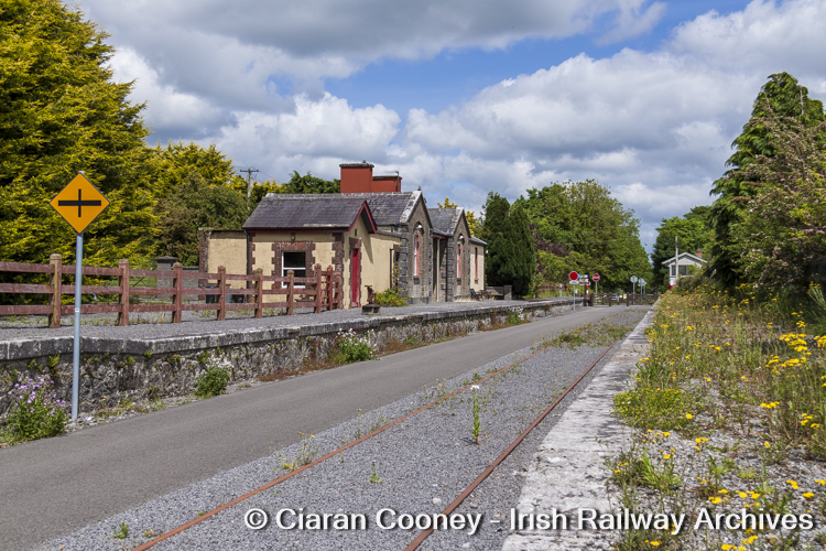
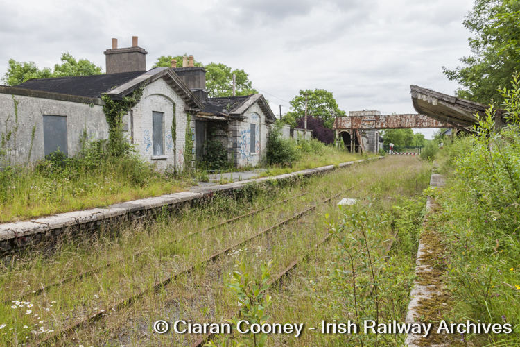
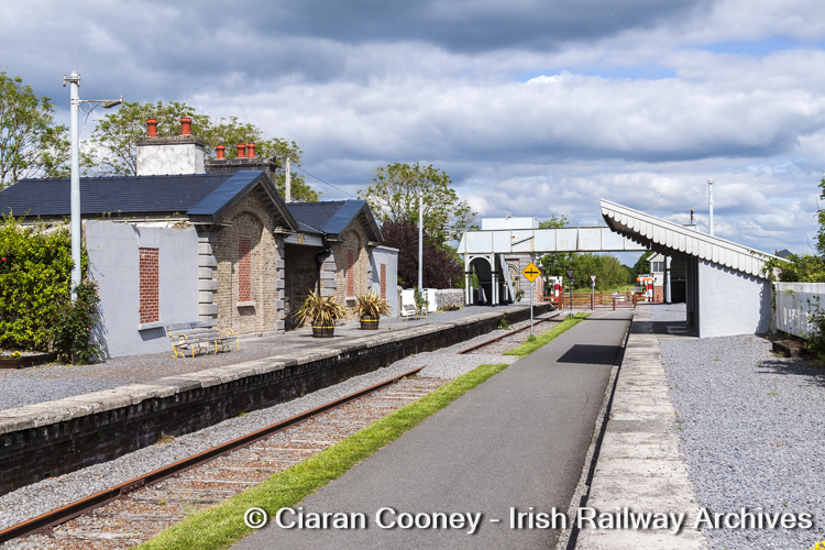
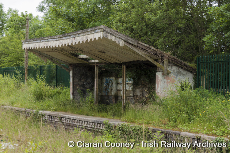
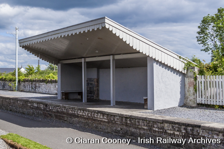
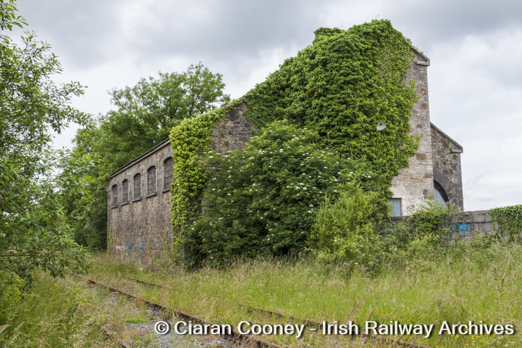
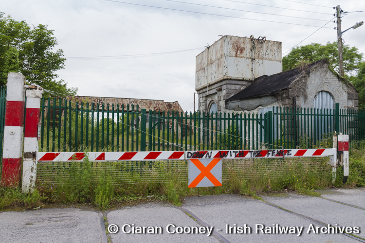
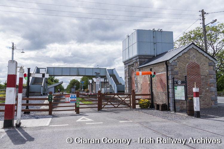
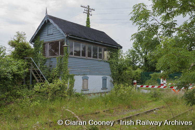
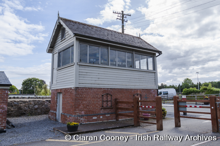
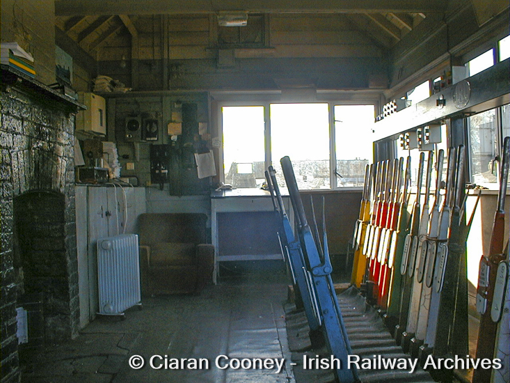
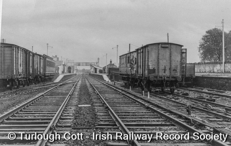
Moate pictured in a very forlorn looking condition during June 2012. This view from the Down platform shows the extent of the weeds and shrubs then growing across the station site. [Photo © Ciaran Cooney] A more up-to-date view of Moate Station in June 2021, showing the signicant restoration undertaken on the Midland Great Western Railway buildings. [Photo © Ciaran Cooney] Moate Station boasts a Midland Great Western waiting shelter featuring a distinctive awning; pictured in a dilapidated conditon during June 2012. [Photo © Ciaran Cooney] The waiting shelter at Moate, now fully restored with its awning during June 2021. The shelter is located on the Down platform. [Photo © Ciaran Cooney] At the Mullingar end of Moate Station is a gated level crossing leading to a golf club. Adjacent to the crossing the Midland style signal cabin, pictured 2012. [Photo © Ciaran Cooney] By June 2021, the old crossing gates have been removed at Moate Station to facilitate access to the greenway. The signal cabin has also been cosmetically restored. [Photo © Ciaran Cooney] Moate during March 2003, looking east towards Mullingar from the station footbridge, showing the watertower, level crossing and signal cabin. The passing loop was on the Down side of the station.[Photo © Ciaran Cooney] The water tower, level crossing and signal cabin at Moate , viewed from the Down platform in June 2021. A couple of semaphore signals have been retained as part of the cosmetic restoration, but the passing loop has been removed to accommodate the greenway. [Photo © Ciaran Cooney] A substantial stone built goods shed still survives at the Athlone end of Moate Station, pictured covered in ivy during 2012. [Photo © Ciaran Cooney] As part of the greenway scheme (Old Rail Trail), the goods shed at Moate has been tidied up. Moate ceased handling goods traffic in December 1975, with sugar beet traffic following in October. [Photo © Ciaran Cooney] Moate, showing the full complement of station buildings as pictured during November 1962. On the loop line in front of the crossing gates is a small PWD trolley. [Photo © Turlough Cott – Irish Railway Record Society] Moat Station buildings, as pictured during June 2021, looking west towards Athlone. [Photo © Ciaran Cooney] Busy scenes recorded at Moate Station shortly before mainline services to Galway and the west were re-routed away from the Athlone-Mullingar line in 1973, filmed by the late Joe St Leger. [Film © Joe St Leger – Irish Railway Record Society] Moate Station, viewed from the level crossing during June 2012, complete with palisade fence, showing the rusty condition of the disused watertower tank and footbridge. [Photo © Ciaran Cooney] Moate Station, showing the much improved condition of the station buildings during June 2021. [Photo © Ciaran Cooney] Moate signal cabin, a typical Midland Great Western structure, recorded during June 2012. This cabin acted as an interface between the signalling systems at either of the Mullingar-Athlone line. [Photo © Ciaran Cooney] Moate signal cabin – this was one of the few cabins not to be destroyed during the Irish Civil War and as such retains its original brick base. The cabin had largely fallen out of use by 2006. [Photo © Ciaran Cooney] The interior of Moate signal cabin, pictured during March 2003 when still intact, albeit not in regular use. [Photo © Ciaran Cooney] The western end of Moate Station, recorded in November 1962, showing the goods sidings on either side of the Up and Down lines. Visible to the right is the cattle bank. The carriages belong to the CIÉ railway signalling and telecommunications department. [Photo © Turlough Cott – Irish Railway Record Society] Bibliography: Mullingar to Athlone , Journal of the Irish Railway Record Society, Vol. 18, No.117, 1992; O’Meara, John, The Horseleap Branch – 2 , Journal of the Irish Railway Record Society, Vol. 23, No. 168, 2009
This archive photo-feature has been compiled by Ciarán Cooney, Hon Photographic Archivist of the Irish Railway Record Society’s library and archives at Heuston Station, Dublin. Further images from the Society’s collection can be found on the IRRS’s Photographic Archive Membership Page
Please follow and like us: